 |
 |
 |
 |
 |
 |
 |
 |
 |
 |
 |

![]()
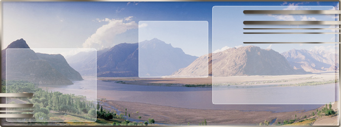
z.B. Malta - Mittelmeerinsel mit bewegter Vergangenheit.
Die Republik Malta umfasst die Inseln Malta, Gozo und Comino mit einer Gesamtfläche von 315,6 qkm. Malta selbst hat etwa 1/4 der Fläche von Berlin. Die Bevölkerungszahl beträgt ca. 400 000, davon sind 91% Katholiken. Das Bruttosozialprodukt Maltas beträgt ca. 4,10 Mrd € in 2006, davon entfallen auf die Landwirtschaft 2%, auf die Industrie 26%, auf den Tourismus ca. 51%.
![]()
e.g. Malta, middle sea island with a busy past.
The Republic of Malta surrounds the islands of Malta, Gozo and Comino with a total area of 315.6 qkm. About 1/4 of the area of Berlin has Malta itself. Approx. 400 000 is the total population, of this 91% Roman Catholics are. The gross national product of Malta amounts to approx. 4.10 bn € in 2006, of this 2% are allotted to the farming on the industry 26% on the tourism approx. 51%.
Der Süden Maltas - Steinzeittempel und Fischeridylle
Im Südosten der Insel Malta, eingefasst vom Grand Harbour und der Marsaxlokk Bay, erstreckt sich eine leicht gewellte Hügellandschaft. Auf weiten Flächen sieht man fruchtbare Terra-Rossa-Böden. Die typische rote Malta-Erde bildet sich aus der Verwitterung des Kalkgesteins, aus dem sich die Insel geologisch aufbaut. Von Norden her steigt das Land sanft zum Plateau zwischen Zabbar, Zejtun und Ghaxaq an. Bei Zurrieq im Süden hat es dann genug an Höhe gewonnen, um über gut 100 Meter als Steilküste wieder ins Meer abzufallen. Bis auf Paola, das noch zum urbanen Gürtel rund um Valletta zu rechnen ist, liegen die Orte relativ geschlossen inmitten von Feldern - es sind eher beschauliche Landstädtchen, in denen die Traditionen auch heute noch zählen. Kirchen prägen das Landschaftsbild, das ansonsten im Wesentlichen durch die Bruchsteinmauern geprägt ist, die überall auf Malta die kargen Felder einfassen.
![]()
The south of Malta, Stone Age temple and fisherman idyll
An easily corrugated hill landscape extends in the southeast of the island of Malta edged by the grand Harbour and the Marsaxlokk Bay. One sees fertile Terra-Rossa floors on wide areas. The typical red Malta earth forms from the weathering of the lime rock of which the island geologically builds up. The country rises gently from the north to the plateau between Zabbar, Zejtun and Ghaxaq. It then has won at height at Zurrieq in the south enough to fall more than more than 100 meters as a steep coast into the sea again. This except for Paola still to the urban belt around Valletta there is a good chance, the places relatively closed lie amongst countries -- it is rather quiet country small towns, in these the traditions counts also today certainly. Churches emboss the view which is otherwise marked essentially by the rough walls which edge the meager fields everywhere in Malta.
Zentral-Malta - aus dem Trubel in die Stille
Zwei ganz unterschiedliche Gesichter prägen den mittleren Teil der Insel Malta, sowohl landschaftlich als auch was die Bevölkerungsdichte angeht. Das Hügelland, das von Norden her sanft ansteigt, geht im Süden über eine deutliche Bruchstufe in das Hochland rund um die alte Inselhauptstadt Mdina über, wo bis zu 280 Meter über dem Meer erreicht werden. Hier finden sich weite unfruchtbare Geröllflächen. Dagegen ist die Tiefebene ein Gebiet aus Globigerinenkalk und fruchtbarer, zumal das Hochland eine Art natürlichen Wasserturm darstellt. Zwischen Mdina und dem Siedlungsgürtel um Valletta erstrecken sich daher große Felder, die zudem weniger von den sonst üblichen Steinmauern zerschnitten sind als im übrigen Malta. Noch krasser sind die Unterschiede in siedlungsstruktureller Hinsicht. An der Nordküste, von den Toren Vallettas bis hin nach San Giljan, breitet sich ein fast unüberschaubares Häusermeer aus; hier grenzen dicht bevölkerte Orte so eng aneinander, dass die meisten Fremden rasch jede Orientierung verlieren. Erst hinter Birkirkara und den Three Villages, wie die Malteser die miteinander verschmolzenen Dörfer Attard, lija und Balzan zu nennen pflegen, wird es ruhiger.
![]()
Central Malta from the hurly-burly into the silence
Two quite different faces characterize the middle part of the island of Malta, both scenic and what tackle the population density. The hilly country which gently rises from the north changes into the highland around the old island capital Mdina over a clear break stage in the south, where meters are reached over the sea up to 280. Wide barren rubble areas are found here. Against this the lowland plain is from Globigerinenkalk and more fertilely an area particularly since this represents highland a kind of natural water-tower. Therefore big countries which moreover are cut by the otherwise usual stone walls less than in other Malta extend between Mdina and the settlement belt around Valletta. The differences are even more glaring in settlement structural regard. An almost incalculable house sea spreads at the northern coast from the gates Vallettas to to to San Giljan; here densely populated places border so narrowly on each other that most foreign parts lose every orientation quickly. First behind Birkirkara and the Three Villagess as the Malteses use to call the villages of Attard, lija and Balzan merged with each other becomes as well it.